
Geophysical Survey and Positioning Services
Our geophysical survey and positioning services deliver precise, reliable data essential for offshore oil and gas projects. We deploy advanced survey technologies to map, monitor, and support subsea infrastructure with accuracy, reducing risks and ensuring smooth project execution.
Overview
Geophysical Survey
We provide high-resolution seabed and subsurface data to support offshore installations, pipeline routes, and hazard assessments. Using cutting-edge equipment like multibeam echosounders, side scan sonar, sub-bottom profilers, and magnetometers, our surveys identify seabed conditions, buried objects, and potential hazards.
Our Core Capabilities Include:
- Bathymetric mapping for seabed depth profiling.
- Side scan sonar imaging for debris and anomaly detection.
- Sub-bottom profiling to reveal sediment layers and shallow hazards.
- Magnetometer surveys for ferrous object detection.
- Route and corridor assessments for pipelines and cables.
Our Services
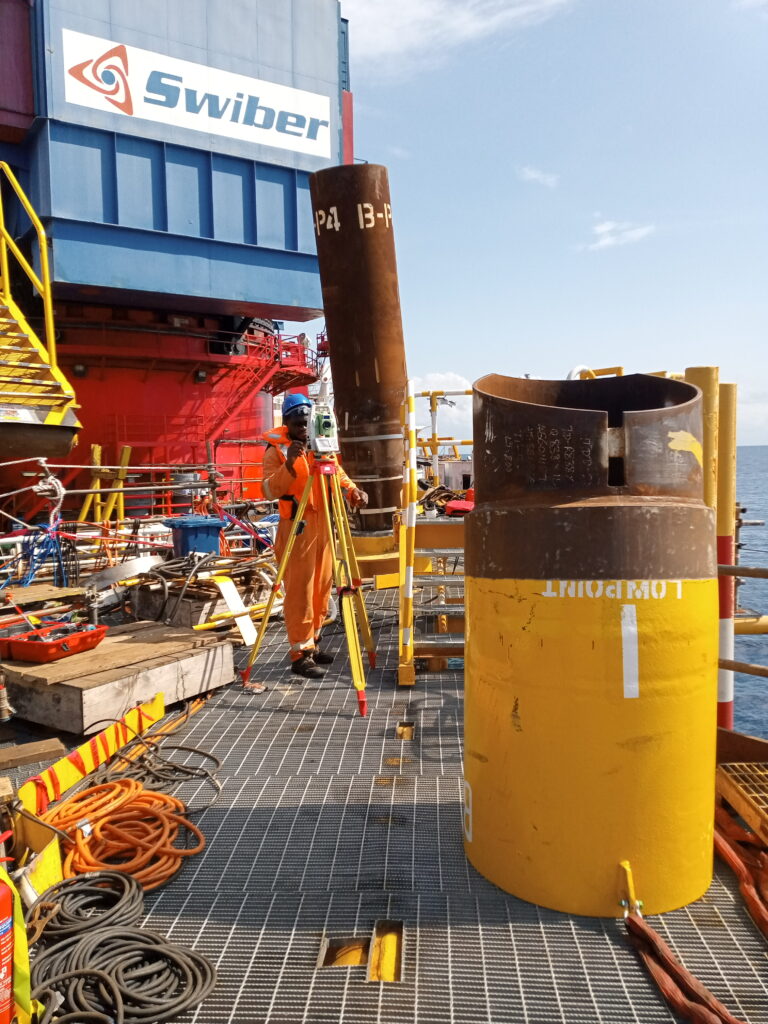
Positioning & Offshore Construction Support
We deliver accurate and safe positioning for offshore operations like platform installation, subsea construction, and heavy lifts. With advanced GNSS, USBL beacons, and motion compensation, we ensure precise asset alignment even in challenging environments.
Key Highlights:
- Real-time positioning and monitoring for offshore assets.
- Pre-construction route surveys and planning.
- Subsea trenching, rigging, and structural placement support.
- Advanced navigation systems that optimize timelines and reduce errors.
Why Choose GOSL?
- Rapid and flexible deployment.
- Reduced mobilization costs with locally maintained equipment.
- Experienced Nigerian teams available 24/7.
- Proven track record across major Oil & Gas projects.